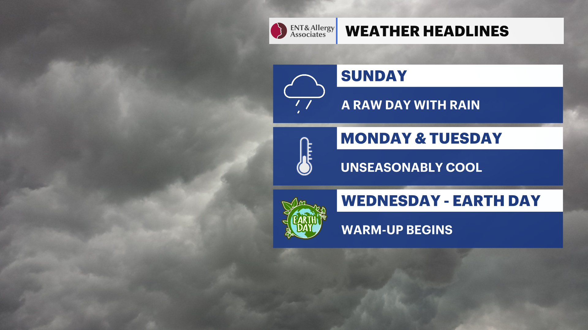
Rainy and raw Sunday across the Hudson Valley; cold blast expected for early next week
Hudson Valley will see wet weather on Sunday followed by a sharp drop in temperatures before a midweek rebound.
More Stories

Alert: Coastal flood advisory from 11 p.m. Sunday to 2 a.m. Monday, with tides running about a foot above normal due to the recent New Moon on Friday.
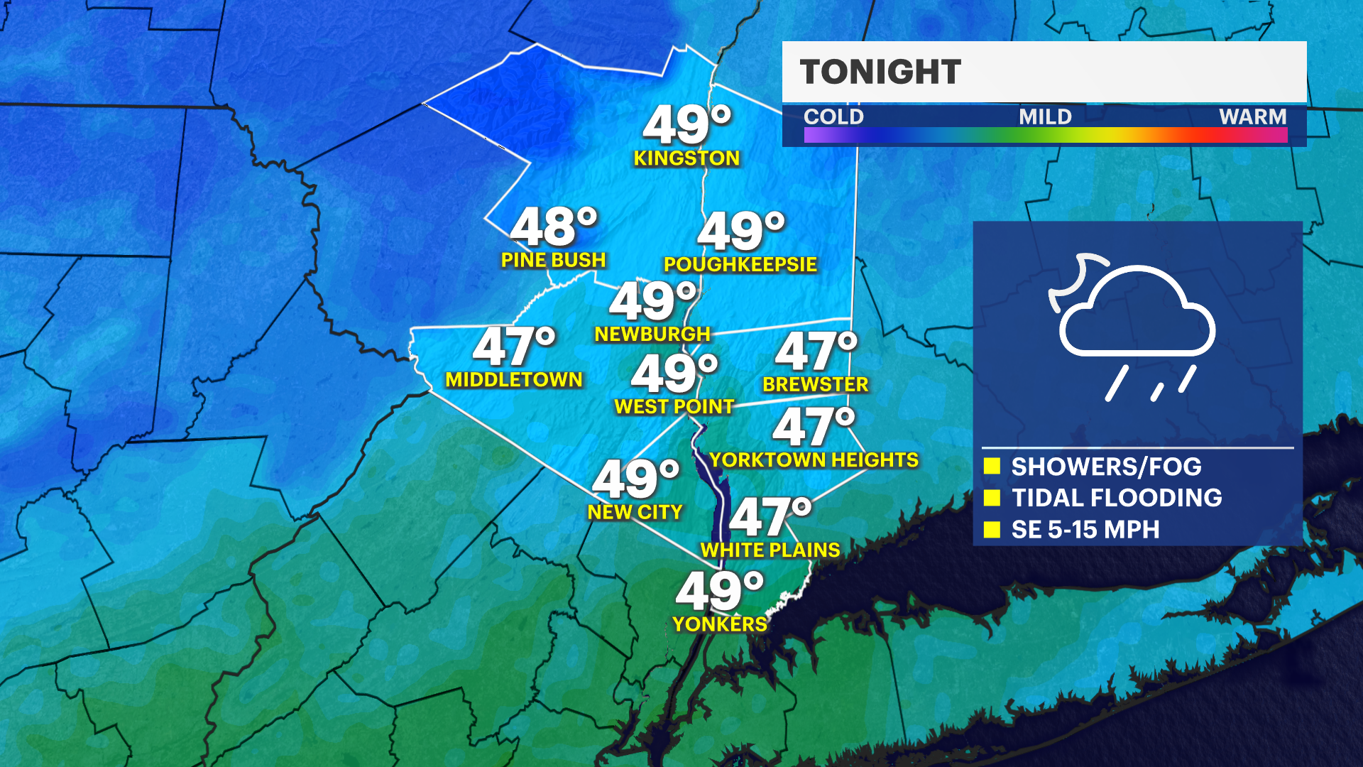
Overnight: Clouds increase across the Hudson Valley as a storm system approaches. Rain will overspread the area overnight. There could be some areas of dense fog.
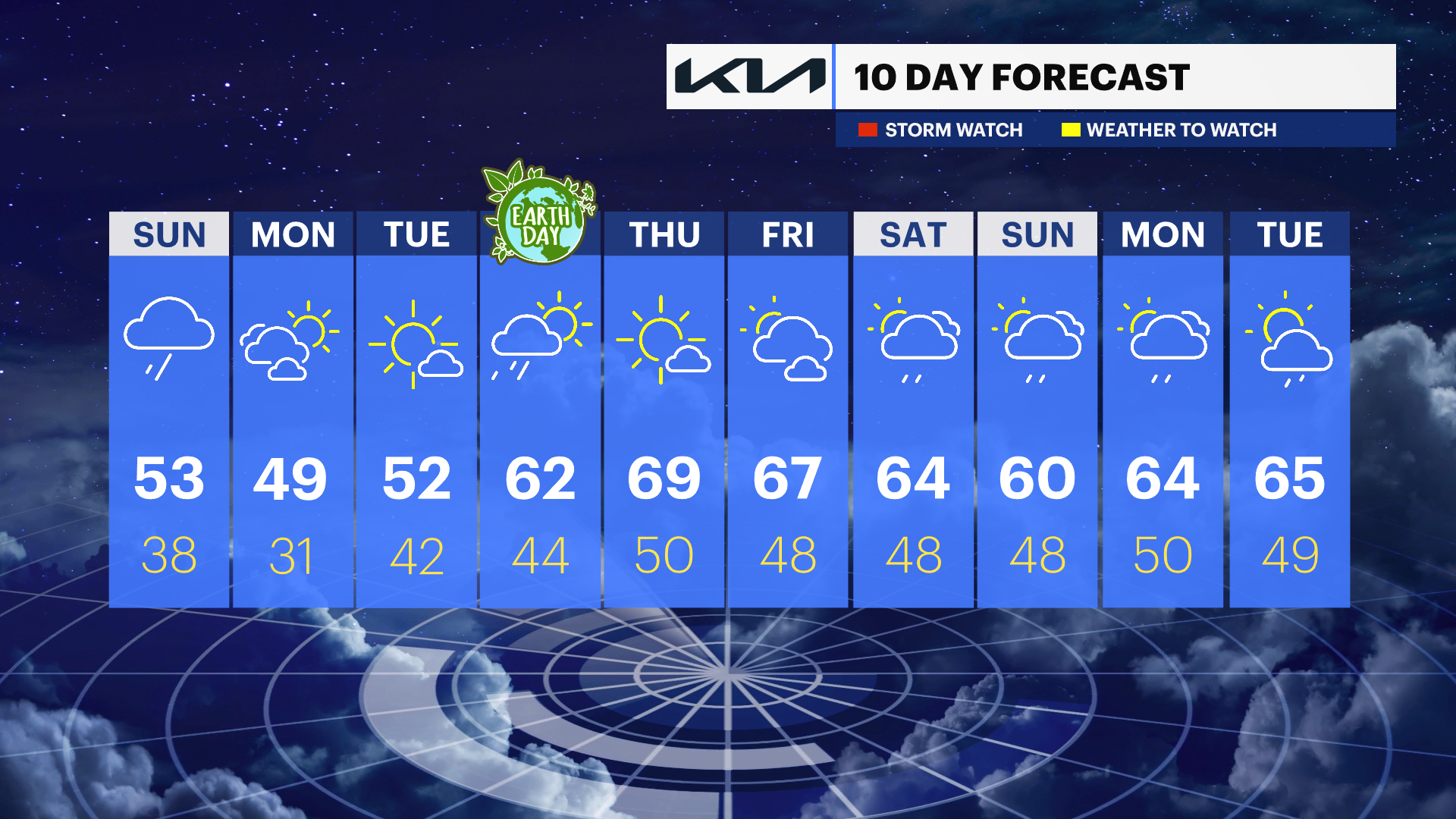
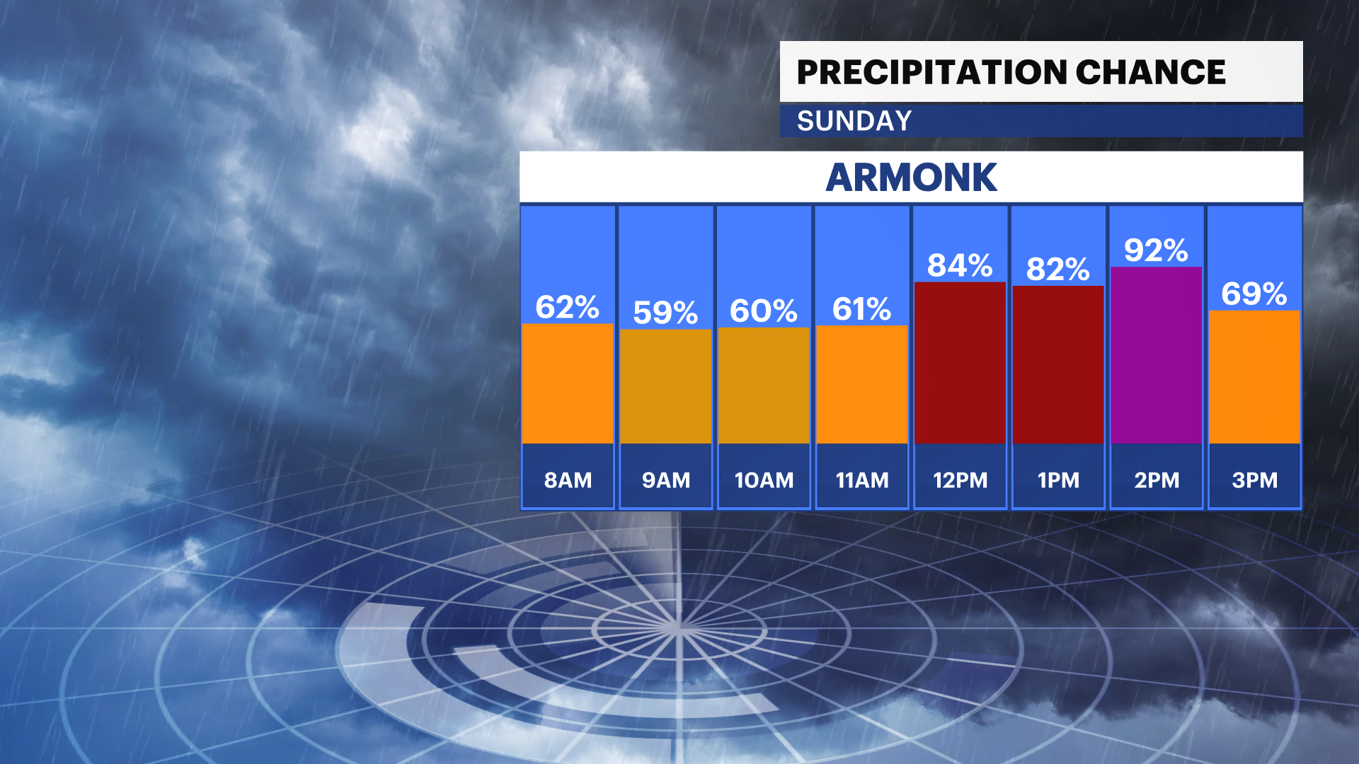
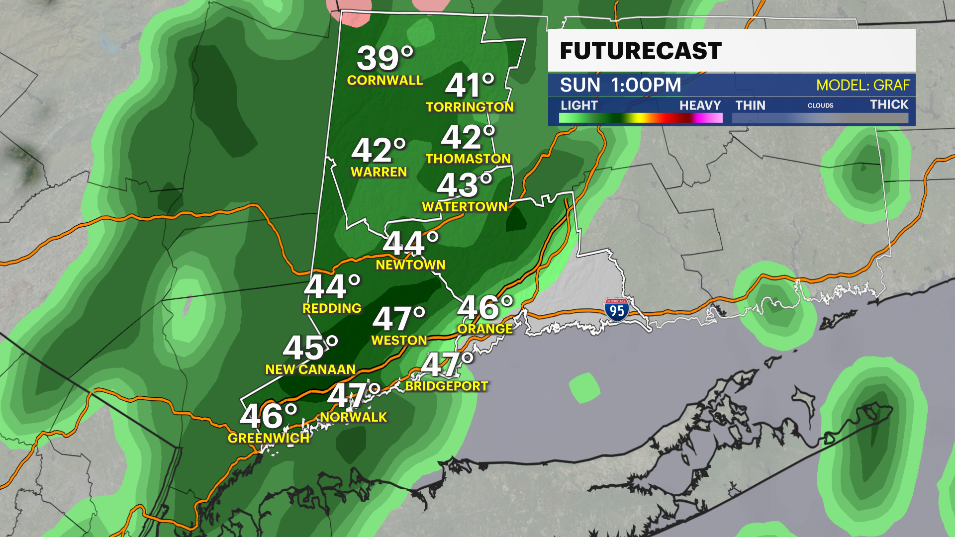
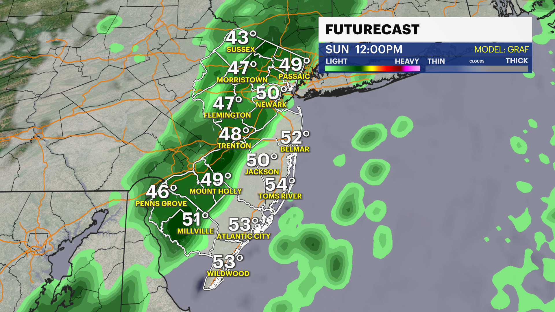
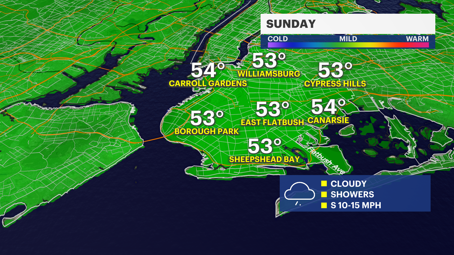
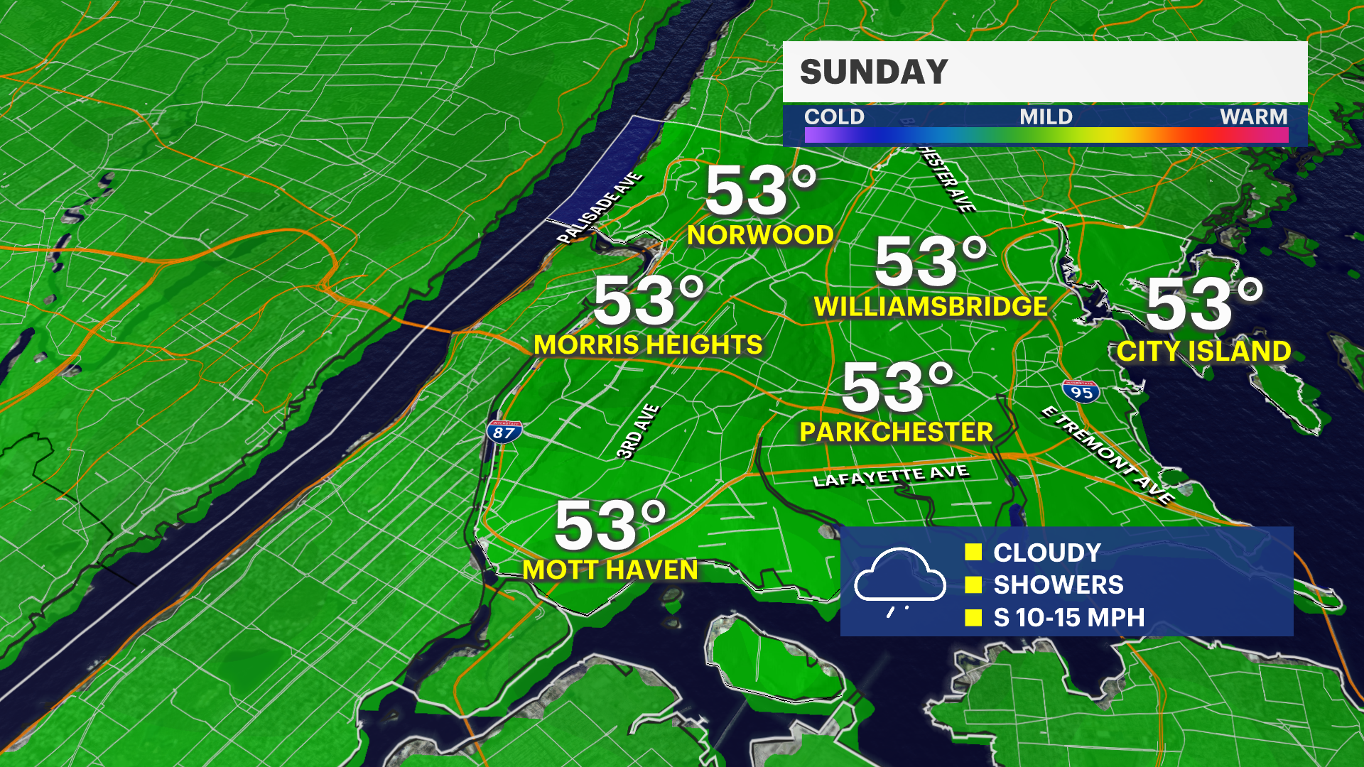
Sunday: Showers move in during the morning as a cold front passes through. Rain will be light to moderate, with minor ponding possible in poor drainage spots. Temperatures will fall through the day, dropping into the 40s by afternoon as colder air moves in.
Monday: Much colder air settles over the area. Expect a mix of clouds and some sun, along with the chance for a few brief pop-up showers in the afternoon. A few could even bring small ice pellets, but no significant impacts are expected.
Tuesday into midweek: The coldest air arrives early Tuesday, with below-normal morning temperatures and a widespread freeze. After that, a gradual warming trend begins, with temperatures steadily climbing back above normal by the middle to end of the week.
Late Week: Temperatures will be near or above average