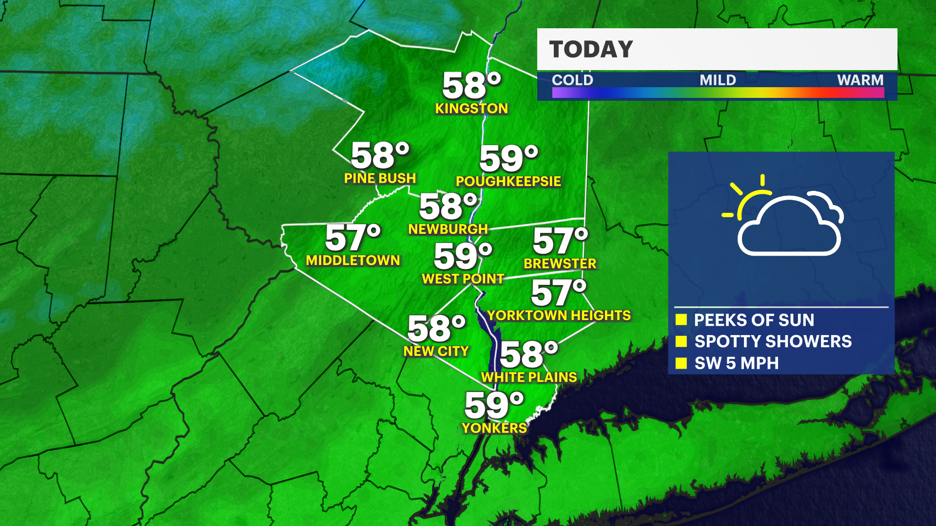
A stray shower today, chilly and dry end to the weekend in Hudson Valley
Peeks of sunshine is expected today, then a cold front brings wind and cold weather Sunday morning. A few spots may drop below freezing.
More Stories
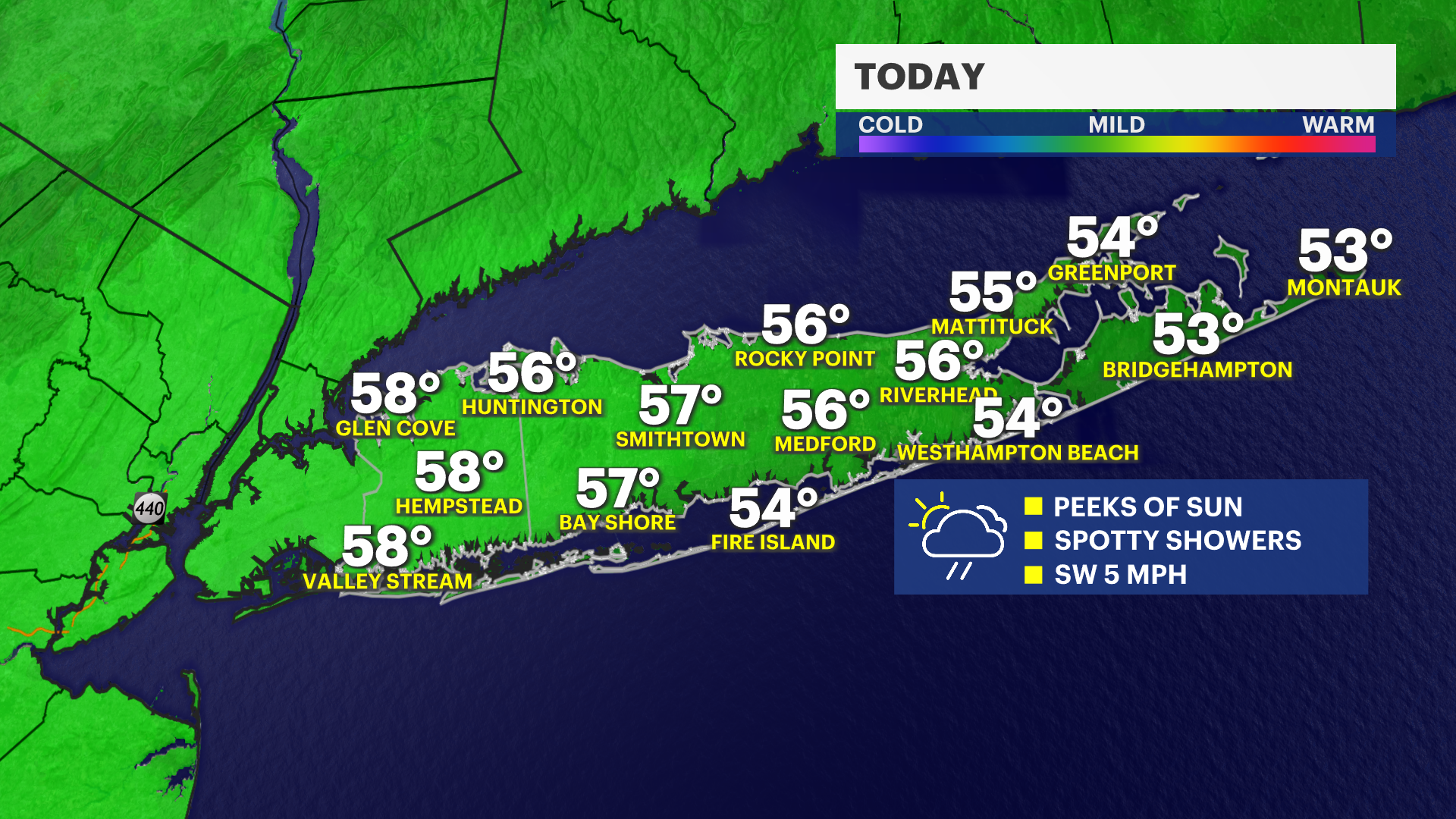


Grab a rain jacket today, and a winter jacket early Sunday morning. We are tracking a few showers this morning on the radar and a vigorous rush of chilly and breezy air tonight bringing wind chills into the 30s for Sunday morning. Sunshine and pleasant weather is expected by Sunday afternoon and it's heating up for Monday and Tuesday.
Cloudy with showers today
Saturday plans are not perfectly dry, but heavy rain is not expected. The sky will be mostly cloudy with a few light showers. Highs are in the 50s for most of the afternoon. Showers will longer in our coastal areas today with peeks of sunshine in neighborhoods farther inland.
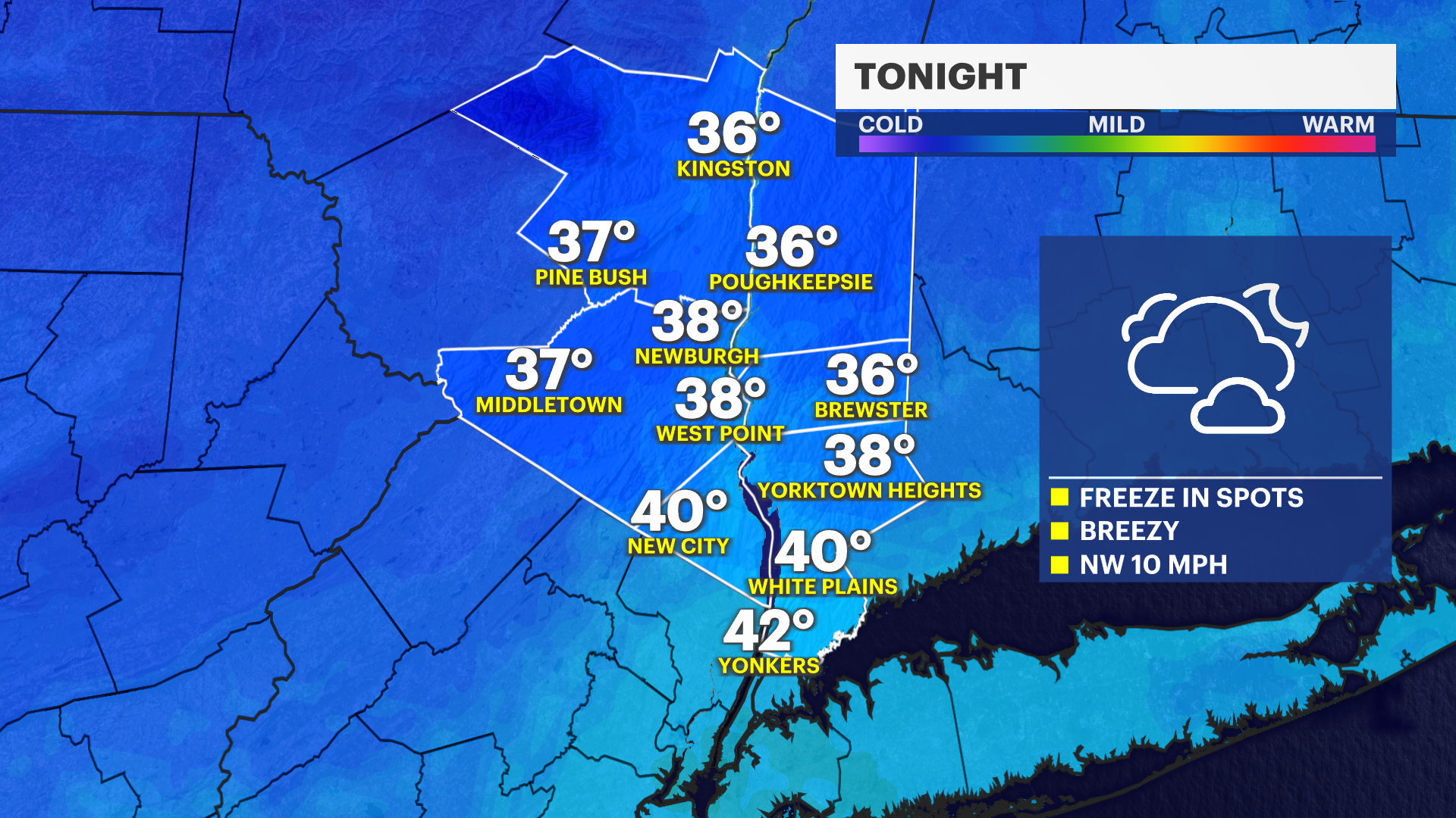
Breezy and cold tonight
Temperatures will feel very chilly this evening into Sunday morning. Overnight lows are near 40-degrees but wind chills are in the mid-30s.
Sunny Sunday
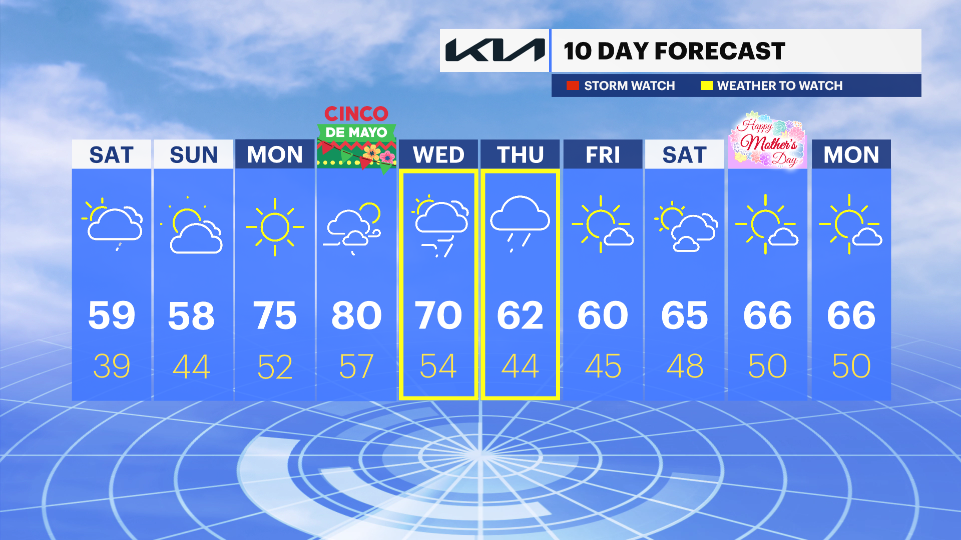
It's a cold start to the day, but a beautiful afternoon. Highs are near 60-degrees although it will feel cool in shade with a NW wind occasionally reaching 20 mph.
Hot start to the week
Temperatures are well above average for Monday, Tuesday, and Wednesday. Warmer neighborhoods will approach 80-degrees on Tuesday.
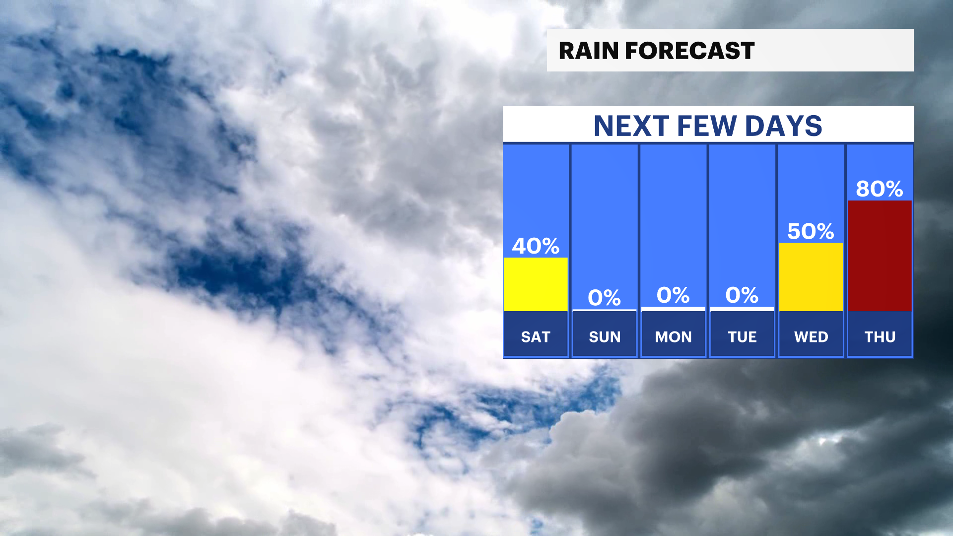
Much needed mid-week rain
Showers are possible Wednesday afternoon. Heavy rain is expected on Thursday which could provide some drought relief.