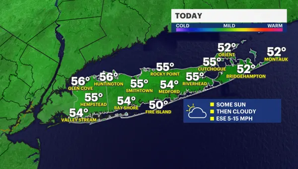
Sunny Saturday, next chance for rain comes Sunday
Storm Watch Team Meteorologist Jon Cubit says for the first day of fall today it will be mostly sunny, windy and cool with highs near 60 degrees. Some of the wind gusts could exceed 30 mph.
News 12 Staff
•
Sep 23, 2022, 9:51 AM
•
Updated 573 days ago
Share:
More Stories
2:05

Mostly cloudy skies and cool conditions on Long Island
2h ago1:01

LIVE BLOG: News 12 weather updates
4h ago2:03
STORM WATCH: Periods of heavy rain, thunderstorms possible to close out the workweek
8ds ago
Guide: Tips to prevent fires during red flag warning
10ds ago2:03
Warmup for the next few days before rain moves in to end the workweek
10ds ago1:52

Long Islanders take part in solar eclipse viewing parties at Jones Beach, Cradle of Aviation
10ds ago2:05
Mostly cloudy skies and cool conditions on Long Island
2h ago1:01
LIVE BLOG: News 12 weather updates
4h ago2:03
STORM WATCH: Periods of heavy rain, thunderstorms possible to close out the workweek
8ds agoGuide: Tips to prevent fires during red flag warning
10ds ago2:03
Warmup for the next few days before rain moves in to end the workweek
10ds ago1:52
Long Islanders take part in solar eclipse viewing parties at Jones Beach, Cradle of Aviation
10ds agoUpdate from the Tropics: Tropical depression 9
has formed and will most likely become 'Ian.' Current models show that the
storm may impact Florida around Tuesday of next week. There is a chance
remnants could affect the tri-state area next weekend. However, it is very
early and much could change. The News 12 Storm Watch Team will keep you updated
on developments as they become available.
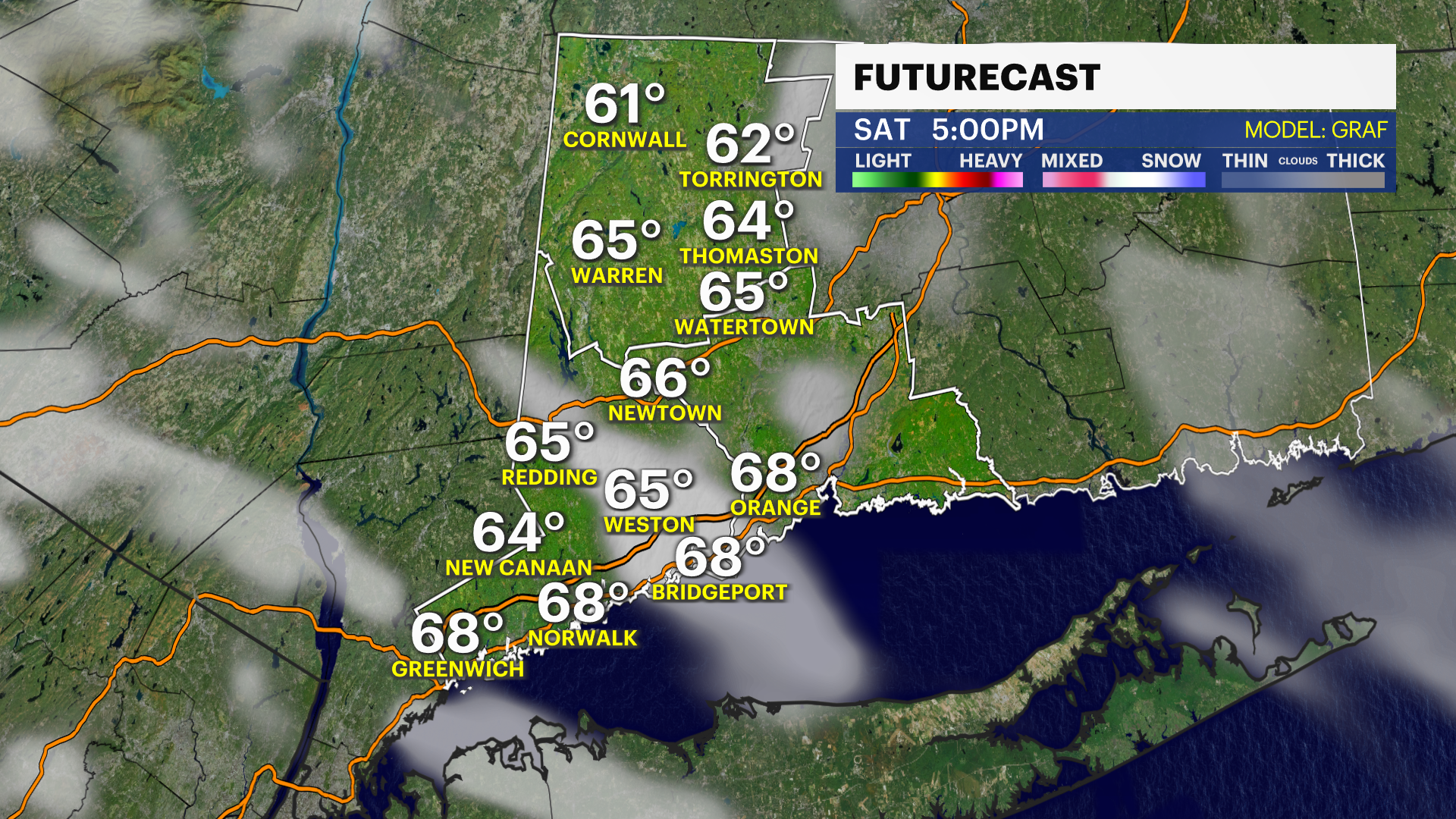
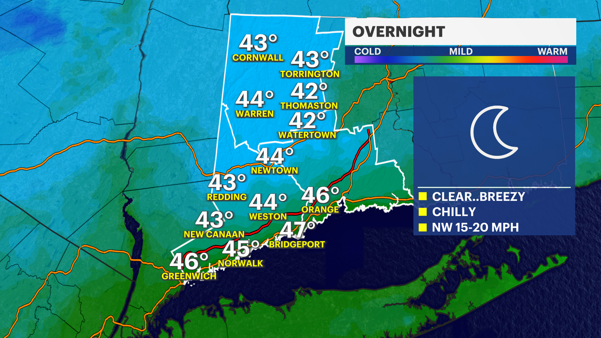
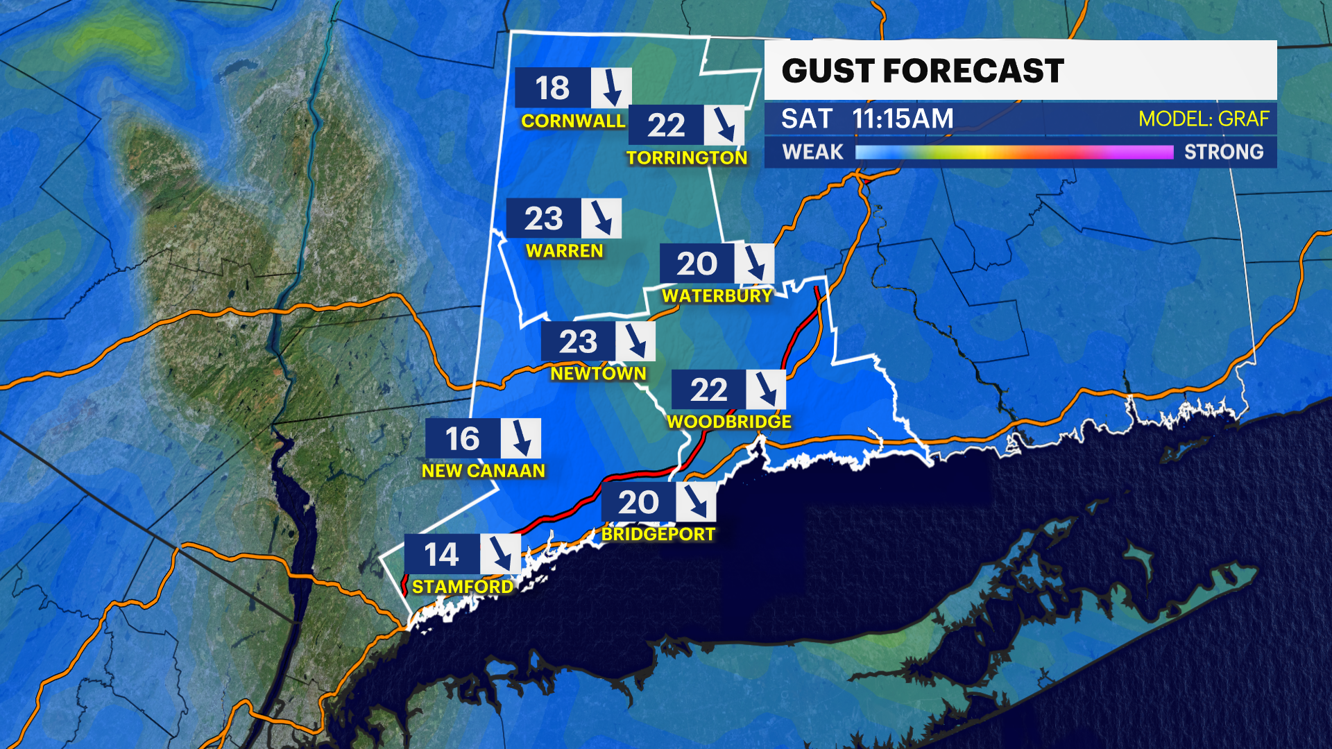
NOW AND NEW: Storm Watch Team Meteorologist Steve Teeling says overnight will be clear and breezy with lows in the low- to mid-40s. Saturday will be mostly sunny and still breezy with highs in the upper-60s.
NEXT: Clouds will increase on Sunday with some scattered showers possible in the afternoon. Next week will feature a mix of clouds and sun with slightly cooler temps as we go through the week.
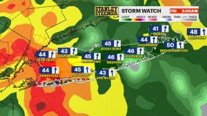
OVERNIGHT: Clear, breezy and chilly. Low of 43.
SATURDAY: Mostly sunny, breezy and a bit milder. High of 69.
SUNDAY: Clouds increase with some afternoon showers possible. High of 73.
MONDAY: A mix of clouds and sun. High of 71.
TUESDAY: A mix of clouds and sun. High of 69.
WEDNESDAY: Mostly cloudy with a few scattered showers. High of 65.