Warm and humid weather continues; some scattered showers move in Tuesday
Storm Watch Team Meteorologist Sam Augeri says expect sun and clouds with highs in the 80s.
•
Aug 29, 2022, 10:09 AM
•
Updated 740 days ago
Share:
More Stories
2:06

Chilly morning, pleasant afternoon Sunday on Long Island
46m ago2:09

Saturn to be visible this weekend, with best viewing on Sunday
21h ago1:39

Why has hurricane season quieted down?
yesterday2:02

Smithtown library remains badly damaged following historic storm
9ds ago
LIVE BLOG: News 12 weather updates
10ds ago1:04

Cooler temperature trend into start of meteorological fall
10ds ago2:06
Chilly morning, pleasant afternoon Sunday on Long Island
46m ago2:09
Saturn to be visible this weekend, with best viewing on Sunday
21h ago1:39
Why has hurricane season quieted down?
yesterday2:02
Smithtown library remains badly damaged following historic storm
9ds agoLIVE BLOG: News 12 weather updates
10ds ago1:04
Cooler temperature trend into start of meteorological fall
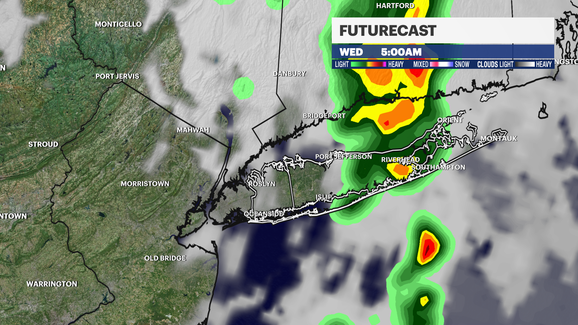
10ds agoWHAT'S NEW: Warm with more mid 80s on Tuesday and some late day showers and storms. It now looks like most of the wet weather will hold off until Tuesday night / early Wednesday morning, with most of the rain coming in after midnight and clearing by daybreak.
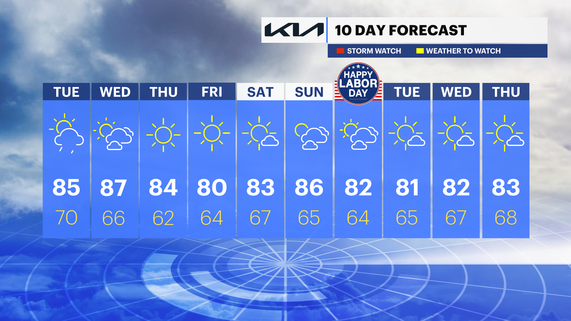
WHAT'S NEXT: Warm dry weather continues with sunshine and daytime highs in the 80s through Labor Day Weekend.
We could have our next named tropical system in the Atlantic by Labor Day. At this time it looks to stays out to sea and far away from Long Island for any big impacts - just some long period swell.
Storm Watch Team Meteorologist Samantha Augeri says expect sun and clouds with highs in the 80s.
SAM'S PICK OF THE WEEK: Friday! Sunny and comfortably warm with low humidity. Nice and refreshing in the morning with highs near 80 degrees.
OVERNIGHT: Partly cloudy and muggy with lows near 70 degrees. Patchy fog in the morning. South wind 5 to 10 mph.
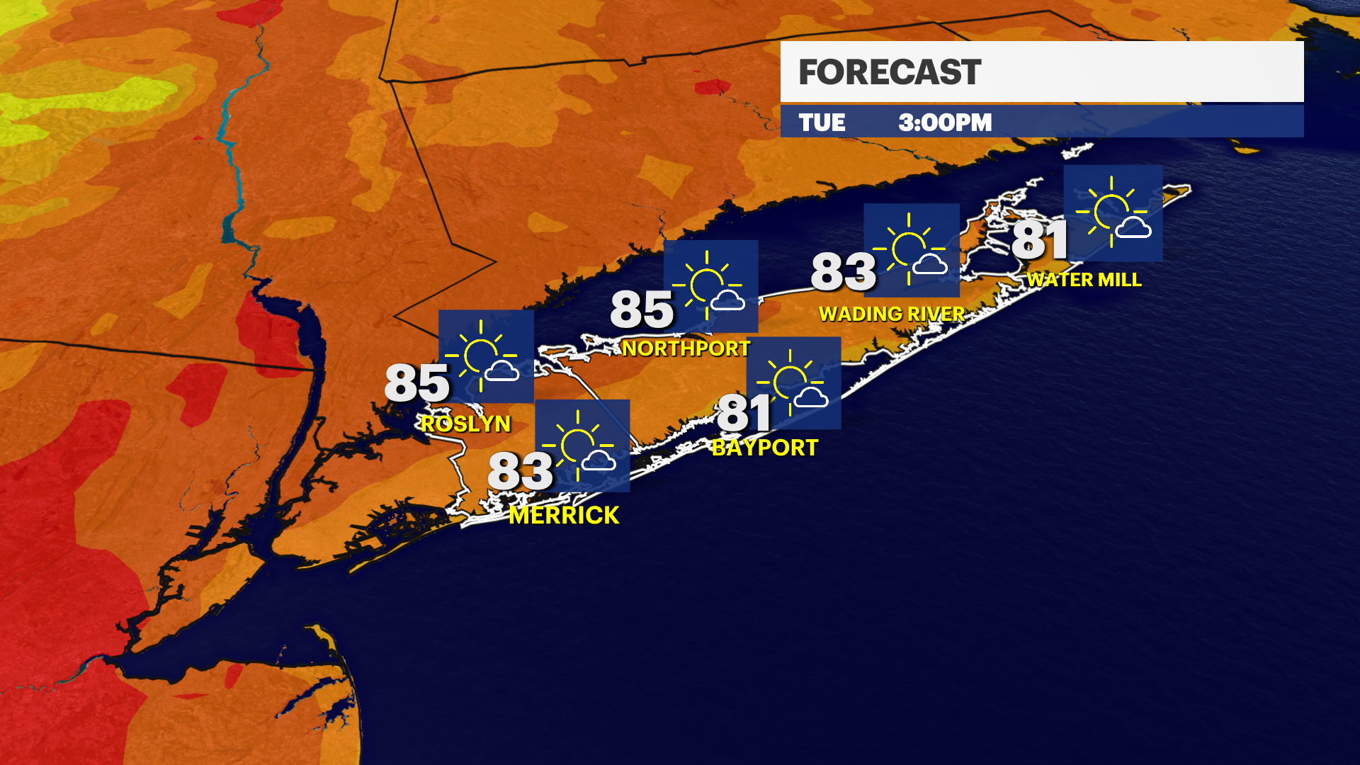
TUESDAY: Warm with sun and clouds. Chance for showers and storms late in the evening through Tuesday night. Highs near 85. Lows near 70. South wind 5 to 15 mph.
WEDNESDAY: Sunny and very warm with highs near 87. Lows near 66.
THURSDAY: Mostly sunny and warm. Nice with low humidity. Highs near 84. Lows near 62.
FRIDAY: Mostly sunny and nice. Highs near 80. Lows near 64.
More from News 12
1:31

Prosecutors detail discovery of woman's remains inside suitcase; Huntington man faces concealment, drug charges
2:06
Chilly morning, pleasant afternoon Sunday on Long Island
0:25

Police: 11-year-old leaves Bayville home with shotgun; father charged with failure to safely store firearm
2:06

Actor Gary Sinise's Lt. Dan Band performs for midshipmen in Kings Point
0:59

Baldwin street renamed in memory of 9/11 responder Bob Beckwith
0:30
